Friday’s high of 96 degrees at DFW marked the end of a three-day stretch of triple-digit heat. While it wasn’t exactly a “cool” day, the slight dip in temperature came thanks to a weak front that has stalled in North Texas, helping to bring some relief and trigger afternoon storms.
Weekend Forecast: Slightly Cooler with Storms Possible
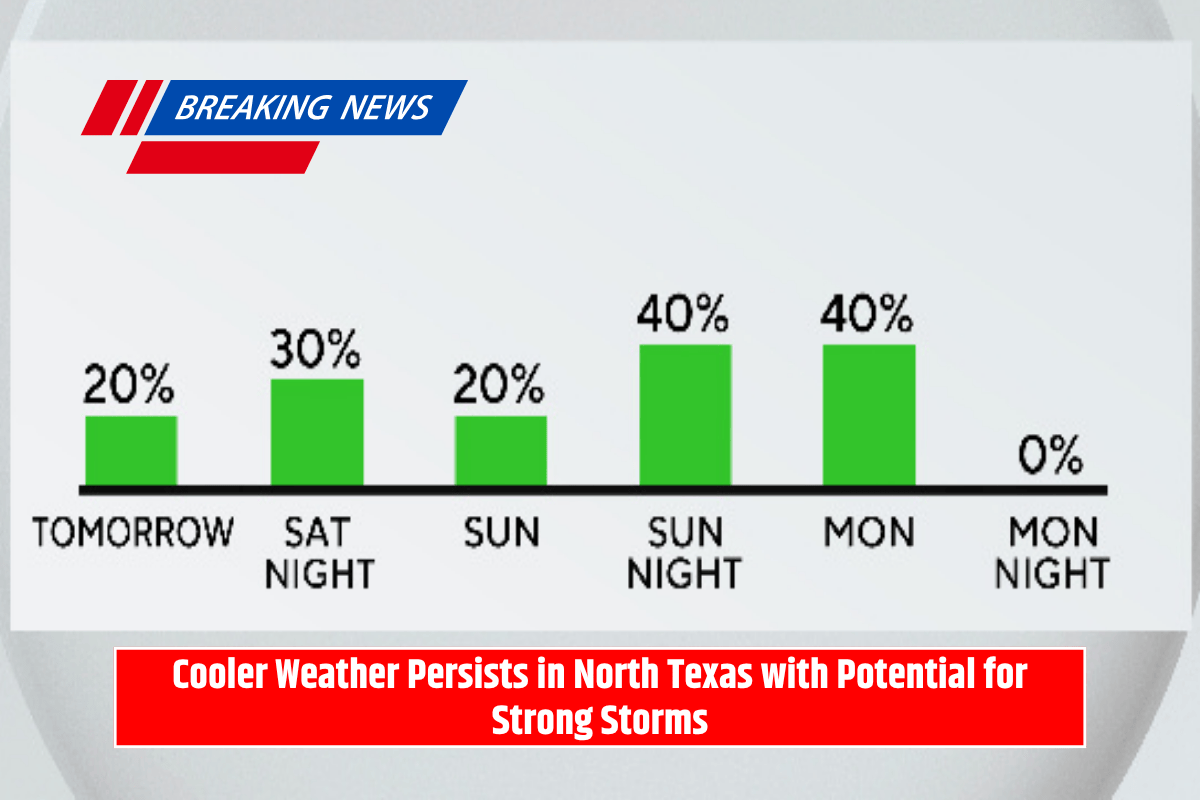
Looking ahead to the weekend, temperatures will be a bit cooler, offering a mild start to what is typically the hottest month of the year. Saturday and Sunday are both expected to bring some relief, with temperatures staying below the intense heat of earlier in the week.
On Saturday, some pop-up storms may develop across southern North Texas, but most areas are forecast to remain dry throughout the day. However, as the night progresses, a storm complex will move in from the north, bringing another round of strong storms.
While severe weather is not anticipated, people outdoors should still be cautious due to the potential for heavy rain, gusty winds, and frequent lightning.
Storms to Continue Sunday Night into Monday Morning
Another round of storms is expected late Sunday night, lingering into Monday morning. These storms could bring more rain and lightning to the region, so it’s important to stay aware of the changing weather conditions.
By Monday afternoon, dry conditions are expected to return as sunshine breaks through, bringing a much-needed break from the storms.
Return to Typical August Weather
As we head into the rest of the week, North Texas will return to its typical August weather. The forecast calls for hot and dry conditions with highs climbing back near 100 degrees by the end of the week.